Read More...
Located in the Salt River Valley in South-Central Arizona, Phoenix has a warm dry climate that is typical of the North American Southwest. The immediate area is gently sloping from both the north and south as the land drops to the river level, but in all directions there are high hills and mountains. Because of the prevailing winds and the soil content of the land, which absorbs heat quickly but releases it just as rapidly, the area is noted for its hot daytime temperatures in the summer and cool climate in the winter months.
Land Geography
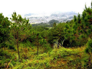
Downtown Phoenix sits at an elevation of 1,058 feet (322 meters) above sea level. The Salt River itself is dry much of the year and becomes filled with water only after periods of heavy rain, which is quite rarely. The combination of hot daytime temperatures and cooler weather during the winter results in a combination of desert flora such as saguaro cactus and mountain variety softwoods like desert pine. The soil is partly sand with a great deal of limestone and calcium chalk which indicates the area was once underwater. This entire region of the United States was once part of the ocean bed and rose significantly after the Rocky Mountains were formed. The rock formations in the area are filled with fossilized remnants of this period and far below ground are many layers of sedimentary rock and localized aquifers. The groundwater itself is very deep and difficult to reach.
Climatic Data
Phoenix boasts over 320 days of sunshine with the majority of them considered sunny as opposed to partly cloudy. High temperatures in excess of 100° Fahrenheit are common during the summer months and evening lows during July and August rarely fall below 75° Fahrenheit. In January the cooler air from the west and the limited daylight hours results in a much cooler climate, with high temperatures averaging about 65° Fahrenheit and morning lows in the mid to upper 40s. Rainfall at Sky Harbor Airport averages less than 9 inches (230mm) annually.
Water Supply
Phoenix has a series of artificial canals that draw water from the surrounding riverbeds and small lakes when rainfall occurs. In addition much of the water directed into the catchment system is taken from the Colorado River and delivered via the Central Arizona Project Canal. The Superstition Mountains to the east and mountain ranges to the south are also dry but contain many ravines caused by water runoff after a short-lived deluge. There are countless arroyos in the lowland areas lined with trees and plants that have adapted to the dry conditions and can survive on only periodic wetting of their roots. Phoenix residents use the canal water in addition to deep wells for their water supply.
Related Posts
-
 Turn Your Scrap Gold Into Money
A highly valuable and precious metal, Gold has a lot of utilities other than
 -
 Cash For Gold
Do you have what it takes to transform carats into liquid assets? Gold dealers
 -
 Scrap Gold Buyers – An Overview
With the global financial crisis hovering over, people are looking for many ways to
 -
 Get The Best Price For Your Scrap Gold
The price of gold goes up when the demand for it is high. You
 -
 What is Scrap Gold? How To Fruitfully Market This Material
Most people are not conscious that one of the most engrossing areas of bullion
 -
 How to sell Scrap Gold to get the maximum benefit?
Gold is a precious metal and getting tremendous importance from ancient time. Gold purchase
 -
 Scrap Gold Buyers – An Overview
With the global financial crisis hovering over, people are looking for many ways to
 -
 Portland Gold Buyers Commodity
To sell gold to Portland gold buyers a person must understand how the system


